What is Survey Flying?
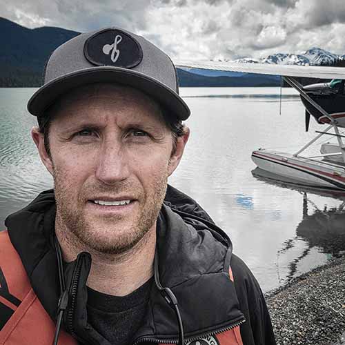
About 4 months ago I was hired as a survey pilot in the Cessna Caravan. I had no idea what is survey flying. The survey company is an international multiphysics company with its main headquarters in Spain. My division headquarters is based in Ottawa at the Ottawa airport.
Before I took this job I really had no idea what survey flying was all about. I saw a few ads on avcanada here and there, but I had no idea what it was really all about. I’d never even met anyone that had gone survey flying.
I certainly know much more about being a survey pilot now. In this video I am going to tell you all about how we fly survey.
When we decide we want to be pilots, most of us probably dream of making it to the airlines. However, what I now know is that there are very rewarding pilot careers in other areas of aviation…such as survey flying.
As a survey pilot I get great health and dental benefits. I also get RSP matching. All of my travel and accommodation is paid for, I get per diems, and all of my recurrent training and medicals are paid for. Furthermore, I am currently going through an FAA license conversion which is also completely covered. There is lots of opportunity for personal growth.
Lets start talking about survey flying. Simply put, survey flying is flying straight lines back and forth in a designated area called a “block”. We usually ferry the airplane from home base in Ottawa to the part of the world where we are going to work. From there we fly to the block every day to work.
The lines could range from a few kilometers in length to a few hundred kilometers. With my job we usually fly at 260 or 500 feet above the ground. It depends on what type of survey we are doing. Regardless of the equipment we are using to acquire data, we are always flying the airplane in straight lines over the ground. There are two pilots in the plane and we take turns flying lines.
Sometimes the speed at which we fly survey will change. Again this depends on the tolerances for each specific job.
How do we know we are flying in straight lines? Well, we have a screen that tells us. That box up on the dash gives us all the information we need. We get the following information.
It tells us the line number and the direction we should be flying it. Just like a runway, you can fly the line from either direction. An example line number might be 15 590 North. And the next line might be 15 580 South depending on if we were working east or west.
We also get our position on the line in a positive or negative number. A positive number that is decreasing indicates that we are currently on the selected survey line between the beginning and end. A negative number indicates we are not yet at the start of the line or that we have passed the end of the line.
We also get our ground speed in meters per second. There may be a ground speed limitation to the survey. Exceeding those limitations would cause a decrease in the quality of the data. Your airspeed may need to be altered slightly depending on headwinds or tailwinds.
Now this is where skill comes into play.
We get information about our vertical track above or below the specified altitude and also information about our lateral track left or right of the specified track across the ground. The tolerances for this are pretty strict, however repetition helps you get very good at meeting the requirements. Generally we want to be flying the airplane within 20 meters left or right and and within 10 meters up or down of the 3 dimensional track through the air. About 60 feet and 30 feet, respectively. However, you are always trying to fly it perfectly. This is like flying an ILS instrument approach all day long. It will make you a better pilot.
Power is the main component for following the vertical drape and ailerons for maintaining the lateral track. You might be wondering what a drape is. I will explain in a minute.
The last bit of numerical information we get on the screen is the true track we need to fly and the true track we are currently flying. If the track we need to fly is three one five, flying three one three for only a few seconds will certainly lead us off track. The lines on the last job I flew were spaced 100 meters apart. So drifting more than 50 meters off the track would put us closer to the next survey line.
It sounds really difficult, and it is in the beginning. But, you get lots of practice and it becomes much easier….and fun. It’s like playing a video game! It’s easy to get lost in it, and time tends to pass very quickly.
Plus, there is so much more to it than just flying straight lines. You need to get really good at interpreting weather and using all weather resources available to make a decision to fly on any given day. In some parts of the world at certain times of the year the weather is always very fair. In other parts of the world, such as Labrador, the air is always saturated.
The airplanes also have to be ferried to and from a wide range of places in the world, such as greenland, africa, the U.S, and south america to name a few recent ones. The beauty of this is that you get to explore a bit if you find yourself in one of these places. Not just check into a hotel, get your 8 hours sleep, and then fly home the next day. You also are challenged with doing all the planning to get the airplane from A to B. There is so much to learn and each tour always seems to be different at this job.
So I mentioned something called a drape. A drape is displayed to us as a line moving across our screen from right to left. It indicates the slope of the terrain underneath us.
On the screen there is also another line being drawn which is the vertical path of our plane in reference to the drape. This is a visual representation of the position of the plane in reference to the drape. Through this we are able to anticipate climbs, descents, and level flight to maintain the predetermined height above the ground we are required to fly to get quality data.
Just match the vertical path of the airplane with the drape. The drape is calculated with known geophysical data about the earth’s surface.
During this job the drape was set at 260 feet. And before you ask, we have special permission to fly at this altitude.
We have 2 types of drapes when we are survey flying; 2D drapes and 3D drapes.
2D drapes only take into account terrain heights that are on the line to be flown. 3D drapes consider terrain to the left and right of the line to be flown.
If the area to be surveyed has large and/or steep changes in elevation the drape knows this and will start a climb or descent at a location that will not exceed the performance of the airplane.
Roughly, this is no greater than 5 degrees.
The key to flying the contour of the drape is to lead the climbs and descents with the use of power. More power to go up, less power to go down.
So hopefully I have painted a somewhat understandable picture of what and how we fly survey.
I love the adventure this job provides. One of my coworkers who has made a career out of survey flying has a map of the world in his garage. On that map he has a pin placed in every spot he’s been. He’s been everywhere! It’s incredible.
Hopefully you now understand what survey flying is. If you have any questions leave them in the comment under the video on YouTube.

Check out our free courses.